Open-source marine chartplotter · beta
Pelorus Nav is a free chartplotter for the browser and Android and iOS, and beyond: official NOAA vector charts with standard modern symbology, offline tide and current predictions, and no account needed. It's young — in beta, improving steadily, and built in the open by a sailor.
Runs in any modern browser — nothing to install, no account needed. The Android and iOS apps are in beta; sign up to join the testing program.
Not for navigation: please treat it as a planning and situational-awareness aid, and carry official charts.
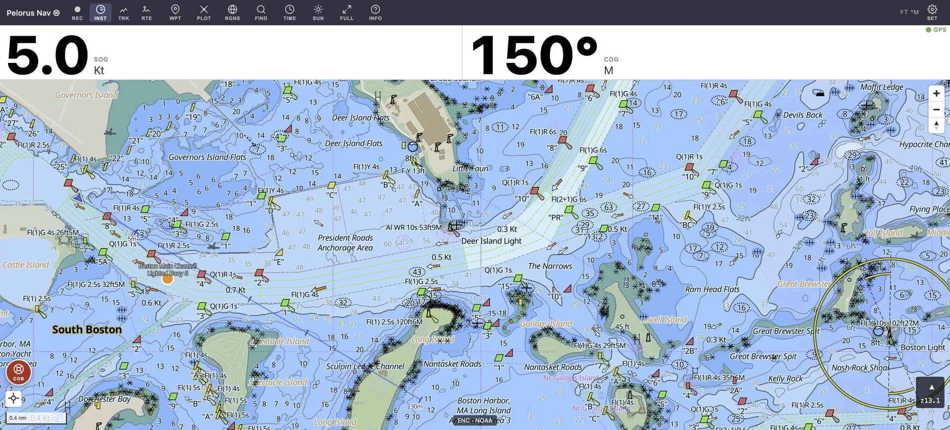
Under way in Boston Harbor — NOAA ENC data with IHO S-52 symbology, live instruments, street basemap blended in near shore.
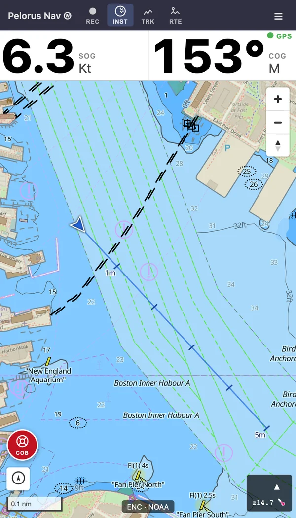
A quick tour — official charts, routes and waypoints, tides and currents, track review, and the crew-overboard button.
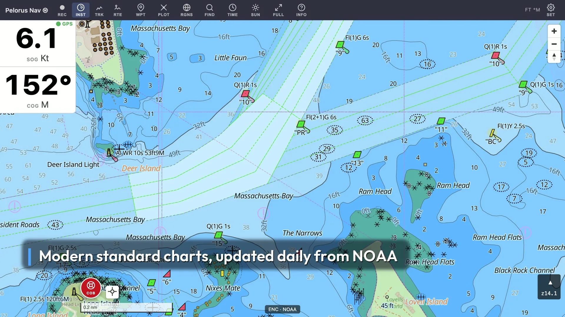
Official NOAA electronic navigational charts — the same public ENC data behind commercial plotters — rendered with standard marine symbology, on hardware you already own.
Vector ENC charts of US coastal waters, the Great Lakes, the US Caribbean, and Hawaii — depths, buoys, hazards, and lights with their real characteristics — in standard S-52 symbology, kept current with NOAA's updates (checked nightly). You can import your own charts too.
Download a region once and charts, tides, and place search keep working without a signal. Saves battery and works anywhere.
Predictions computed on-device from NOAA harmonic stations; thousands of tide and current stations.
Routes, waypoints, track recording and playback, course projection, an anchor drag alarm, and a crew-overboard button.
The device's own GPS works out of the box, and Bluetooth GPS pods pair in a couple of taps. Signal K and NMEA connections are implemented too, though early and still only lightly tested.
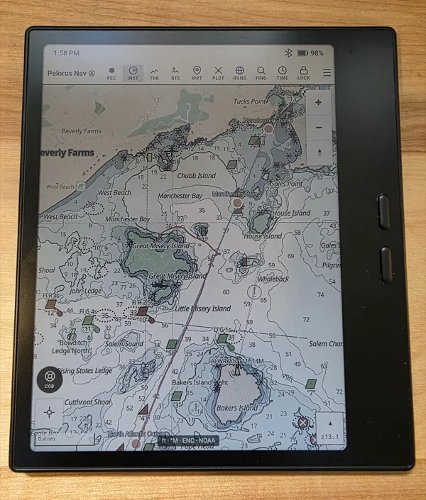
Marine display themes for real conditions, including one tuned for sunlight-readable e-ink tablets.
Day-sailors, club racers, charterers, dinghy cruisers — if your "chartplotter" is the phone in your pocket, this is for you.
Pelorus Nav should run well on the phone already in your pocket. But if you want a dedicated cockpit display, this is the field-tested setup the app is developed on:
Both receivers are tested regularly with the app on real sails, and because they're Bluetooth you can just turn them on and keep them in your bag. These are often available used on Ebay for $60-90 or so. Most other Bluetooth NMEA receivers should work too. I have no affiliation with any of these manufacturers, these are just what are working well for me. The Dual should also work with an iPad without a GPS, though I haven't tried that.
Pelorus Nav is MIT-licensed and developed in public — the code, the chart pipeline, the roadmap, the mistakes. You can read it, file issues, build your own, or self-host the whole thing.
Being open source is also a promise of continuity: the code and the free charts will be there for good, whatever comes next for the project.
Pelorus Nav is conceived and built by a professional software engineer with 45 years of experience in high performance graphics software, Gary Oberbrunner. I strongly believe in creating the highest quality code and a beautiful user experience, so all the code is thoroughly tested end to end, and code-reviewed frequently to reduce errors and ensure security.
A pelorus is one of the oldest and simplest navigation instruments: a compass card with sighting vanes and no needle — a "dumb compass" — used to take bearings of a lighthouse, a headland or another ship, relative to your own heading. It was standard equipment on ships' bridges for centuries. Taking bearings on what you can actually see is the heart of coastal navigation, and that spirit — a simple, reliable instrument that helps you look outside the boat — is what this app aims for.
Tradition says the instrument is named for Pelorus, Hannibal's pilot. The story goes that as Hannibal's ship approached the Strait of Messina, the passage looked closed, a dead-end bay — and Hannibal, suspecting his pilot of treachery, had him killed. When the strait then opened before them, Hannibal, in remorse, raised a monument to Pelorus on the headland — which still bears his name today: Capo Peloro, the northeastern tip of Sicily.
Pelorus Nav iOS and
Android apps are in beta (iOS through TestFlight; Android through the
Play Store's closed testing, or as the signed APK from
GitHub releases),
and feedback from sailors
actually using it is what shapes it: what works, what's missing,
where it should go next. Leave us your email below if you're
interested in testing and we'll get back to you to add you to the
beta for iOS or Android. (On Android, please use the email you use
to log in to your phone).
Try it on your boat, then tell us what you think — open a GitHub issue or just send a bug report from within the app (INFO → Report a Bug…).
(There's open hardware taking shape too — a
sunlight-readable e-ink chartplotter — and the list hears about that first.)
Just an email list — unsubscribe anytime, never shared.